Lot
Kip's Bay Farm
Lot Group
Original Grants and Farms
Property Was Used in 1660 For:
Original Grants and Farms Document(s)
Grant Lot Document(s)
Tax Lot Events
Full Stokes Entry (See images below)
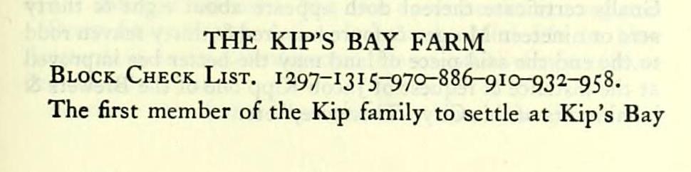
HE KIP'S BAY FARM Block Check List. 1297-1315-970-886-910-932-958. The first member of the Kip family to settle at Kip's Bay
was Jacob Hendricksen Kip, second son of Hendrick Hendricksen Kip, the founder of the Kip family in America.
Hendrick Hendricksen Kip came to New Amsterdam earlier than August, 1635, with his wife Tryntje and five children. In an entry in the minutes of the directors at Amsterdam, under date of Nov. 15, 1635, he requested payment of 326 guilders, 19 stivers, and eight pennies, due him "according to the bill of exchange dated August 15, 1635, and signed by Wouter van Twiller and Marten Hendricksen." — Chronology.
Hendrick Hendricksen Kip had a grant for a lot on the Brug Straet — Lot 12, Block E., Map of Dutch Grants. This was not placed upon record until April 28, 1643, which is the first time his name appears in the record, in the new world. It was confirmed to him, Sept. 17, 1667, which is the latest mention of the founder noticed in the records. For this settler see Vol. II: 260-382, and other indexed references.
Jacob Hendricksen Kip was born in Amsterdam, May 16, 1631. As early as 1647 he was clerk in the office of the provincial secretary. In December, 1649, he was acting clerk to Director Stuyvesant's Council.
He was appointed, Jan. 27, 1653, first secretary to the Court of Burgomasters and Schepens of New Amsterdam, an office which he resigned, June 12, 1657.
There is a tradition, which has been repeated so often that it has been accepted as a fact, that Jacob Kip built the mansion house at Kip's Bay in 1655. Nothing in the records can be made to prove this early date.
After Kip resigned the office of secretar)', in 1657, he led a very active life in the little town of New Amsterdam, until 1674, when he served his last term as Schepen, in the Colve administration; an office which he had held at intervals since 1659. In November, 1662, after his return from a visit to Holland, he was engaged in brewing in New Amsterdam. Almost every court day, after 1657, his name appears on the records as referee or arbitrator. The court usually included him in conference with other prominent citizens.
It seems improbable that he should have lived so far from the town as Kip's Bay then was and still have remained in such close touch with its daily affairs.
A study of the Records of New Amsterdam proves that Jacob Kip was one of the most active men in the community.
However, tradition is entitled to respect. Whenever the house was built, it was built on the Stoutenburgh farm. Certainly the family lived there before 1664, in which year old Hendrick Hendricksen Kip, the founder, lived with them. He may have managed the farm when his son was unavoidably absent. Dominie Selyns states that he died there.
1664, March 24. Discontinuance of a suit between Govert Loockermans and Burger Joris, and order to said parties, Jacques Corteljou, Herman Smeeman, and Hendrick op Kippenburgh, to attend the council. — Cat. Hist. MSS., Dutch, 263. This is the earliest reference to Kippenburgh found.
The reference to his death is found in an entry in 'T Ledematen Boeck Oft Register der Ledematen Alhier 't Sedert de fare i6^g (The Member's Book or the Register of the Members here at [and] since the year 1649). In the possession of the Consistory of the Ref. Dutch Ch. (New York). A copy in the N. Y. Geneal. i3 Biog. Rec, Vol. IX (1878).
Hendrick Kip's name appears in the list; • in the margin Dominie Selyns has written: "Obyt op Kippenburgh." He gives no date. It must have been later than Sept. 17, 1667, when Kip's lot in town was confirmed to him. — Vol. II: 382.
Possibly additions were being made to the house when the following letter was written.
"Mrs. Mary Kip. After salutation; These friends come to counsel with you as to the best and most proper way to manage it with Johannesie Kip, the youngest child of your husband, my brother deceased. 'Tis such I should also have come, but have just now in daily employ four strange masons, and cannot leave them . . . Hoping that both sides may agree in all friendship, for the best; whereof not doubting, commend you to God's protection, and remain.
Your affectionate
Jacob Kip. 1678, the 26 July Kipsberry."
The letter is printed in full in Riker, History of Harlem, at page 394. The original is preserved in the Riker Collection, in the N. Y. P. L.
The Kip mansion stood at the south side of 35th St., and partly in the bed of the street, about 100 ft. east of Second Ave. The grade for opening 35th St. was established, Aug. 14, 1851. The actual opening soon followed. Therefore the house must have been demolished late in 1851. See L. M. R. K., 950.
The Rev. William Ingraham Kip speaks of visiting the old house when it was in process of demolition. His memories are pleasantly described in a booklet, The Olden Time In New York.
The Kip's Bay farm as finally established comprised the grants of four early settlers:
A. "Schepmoes Plantation," the most northerly.
B. "Gregorys Plantation," which adjoined it.
These were the two farms which Jacob Kip, the secretary, owned:
C. "Pieter van der Linde's Plantation."
D. The grant to Tunis Cray.
Maerschalck testified, in 1771, that he had run out the four patents. No doubt this survey is the map referred to in Chronology under date of 1751. From his statement, and the statement of Bancker, in 1788, it seems probable that the Kip family had the original ground-briefs. Only one of them was ever recorded. That was the Lovelace grant of 1671, which conveyed the northerly tract.
At a meeting of the common council held on March 20, 1771, the committee appointed to inquire into the encroachments made upon the Corporation Lands in the Out Ward stated:
"We do also further report that we have endeavoured to get the Patents under which Kipp claims his Land but have not been able to procure them, tho' we are informed by Mr Marshalk the Surveyor that he formerly run out the Boundaries of the several Patents under which Kipp claims at his Request that the Lands are held under four different Patents the three Northermost of which bind him upon the Country Road [the Boston Post Road] and the Southermost extends from the East River 130 rods into the woods which are now deemed Common Land. . . . Kipp has also inclosed a small piece of Land the property of the Corporation which he claims under the Patent granted to Priscilla, William & John Holmes." — M. C. C, VII: 274. (This seems to have been the piece which Jacob Kip petitioned for in 1684. In 1771 Jacobus Kip, grandson of Jacob Kip, was the owner.)
A. Schepmoes Plantation
The most northerly plantation was occupied at an early date by Jan Jansen Schepmoes and his partner, Claes Sybrantsen de Veringh, mariners. The plantation seems to have belonged to Sohepmoes. He probably held under permission of Van Twiller and the council. However, Claes Sybrantsen lived there. (See the Van der Linden grant for recitals.) Before September 3, 1638, the partners had bought a sloop from one Captain Taylor. — Cal. Hist. MSS., Dutch, 3.
Possibly this was the vessel that gave its name to "the old wreck brook." It may have been wrecked in the bay into which that stream emptied.
Both men had homes in the town. Schepmoes lived on Pearl St., Sybrantsen on the Slyck Steegh.
Brief biographies of these settlers will be found in Vol. II: 282, 301.
Schepmoes sold his plantation to Baxter and Herfoots. The deed was not recorded until a year later than the patent issued. No doubt it was delivered eariier.
Jan Schepmoes to George Baxter and Walter HartFOORT. Deed recorded Aug. 20, 1641. — Records New Neth., I: 264.
Conveys his house and plantation.
Willem Kieft, Director, etc., to George Baxter and Walter Herfoots (Harfoorts), Ground-brief dated Aug. 29, 1640. — LiierGG: 41 (Albany).
Conveys "A certain piece of land on the Island of Manhatten, extending in breadth betwixt the two creeks," the one "where the water ripples over the stones," and the other where "the tree lies over the creek," and this with "the same breadth betwixt both the creeks into the woods."
"The creek where the beech tree lies over the water," also called "the Kill of Schepmoes," formed the south boundary of the Holmes patent. It entered the East River just north of 39th St. "The creek where the water ripples over the stones," entered the river north of 37th St.
Baxter and Herfoots seem to have sold the farm to Nicholas Stillwell. Nothing found of record.
March 5, 1642. Nicholas Sloper (Stillwell) stipulates to fulfill George Baxter's contract. — Records N. Neth., l\: 11.
March 4, 1649. The farmers on the Island Manhattan request by petition a free pasturage between the plantation of Schepmoes and the fence of the Great Bowery No. I. The petitioners request is provisionally granted, also, that no new plantation shall be made or granted between said fencing. — A^. Y. Col. Docs., XIV: no. The plantations of Harry Piers and Peter van de Linde could not have been occupied at that time.
Nicholaes Stylwel to Lubbert van Dincklagen. Deed dated April 18, 1653.— Li^fr i///: i, 28 (Albany).
Conveys "a piece of land on the island of Manhattan, heretofore occupied by Jan Schepmoes, extending in breadth between both the Creeks, to wit, where the water runs over the stone and where the tree lays over the creek, where George Homes is next adjoining and with that breadth according to the said creeks, straight into the woods."
Lubbertus van Dincklagen, after a stormy career in New Netherland, was expelled from the council by Stuyvesant in 1651. He died in 1657 or 1658. — Jameson, Narr. N. Neth., 338»-
His plantation was granted to Kip by Lovelace, April 15,
Jacques Cortelyou made a survey of this plantation, April II, 1671. His report, in Dutch, is preserved in the State Library in Albany, in Land Papers, I: 39.
Francis Lovelace, Governour, etc., to Jacob Kipp.
Patent dated April 15, iSyi.—Liier Patents, III: 99 (Albany).
"Whereas there is a certain piece of wast land upon this island Manhattans in his Royall Highness Disposal! fit and convenient for a Hopp garden & plantation lyeing & being towards the East River between the land heretofore belonging to Wm. Holmes & that of Peter Stoutenbergh Bounded on the Northeast & Southwest with two small creeks or Kills on the Southeast side with the East River and on the Northwest with the Old Highway towards New Harlem & soe stretching alongst the said Highway Southwest. Contayning as by the Surveyor Gnalls certificate thereof doth appeare about eight & thirty acre or nineteen Morgen & foure hundred & thirty seaven rodd to the end the said piece of land may the better bee improved at the instance & request of Jacob Kipp one of the Brewers & inhabitants of this City. Therefore," etc.
"The Old Highway towards New Harlem," the later Eastern Post Road, was known to De Vries in 1642 as "The Wickquasgeck road over which the Indians passed daily." — Jameson, Nar. N. Neth., 213.
Petition of Jacob Kipp for a grant of a piece of land lying between Turtle Bay and Peter Stoutenburgh. Dated July 9, 1684. — Land Papers, \\: 50 (Albany).
"To the Honl'ls Tho Dongan, Leiut. Governor &c. The humble petition of Jacob Kipp an old Inhabitant of this County Sheweth: That your Petition'' having for severall yeares Possessed and enjoyed a tract of Land between Turtle Bay and Peter Stoutenburgh, containing about nineteene morgen or thereabouts and having by God's Providence in the time of living upon said land twelve children all liveing and most of them growne up which doe want some land for to settle themselves thereon and there being a certain parcell of land lying and being Round in a Criple Bush to North the said land where your petitioner liveth on which will be very convenient for your petitioner and family to settle thereon for present improvement. Doe pray for a grant of the same."
This petition was not granted. However, by 1771, a part of the land was in possession of Jacobus Kip, grandson of the petitioner of 1684. The encroachment was to be investigated by a special committee. — M. C. C, VII: 272-5.
The rest of the Cripple Bush became vested in Cornelius Vanderhoof.
B. Gregory's Plantation
Just south of Schepmoes's plantation was Gregory's plantation. It was named for an early settler who has not been positively identified. He may have been Gregory Pietersen, who owed Peter Van der Linde for surgeon's fees in 1639 (according to an entry in Cal. Hist. MSS., Dutch, 11). This Gregory Petersen, a soldier, was tried tor mutiny, found guilty, and sentenced "to be shot to death," Aug. 4, 1638 {ibid., 68). The sentence was not carried out — he was still here in January, 1642 {ibid., 79), which is the last time he is mentioned in the records. Probably he left New Amsterdam shortly afterward; his plantation was re-granted as follows:
WiLLEM KiEFT, Director, etc. to Harry Piers. Groundbrief dated April 15, 1647. — Liber GG: 214 (Albany).
Conveys "a plantation known by the name of Gregory's plantation, extending between Pieter van der Linden's plantation, and the kil where the water runs over the stones and abutting on Schepmoes's plantation; its breadth on the East River is 75 r.; it stretches on the said river north-east and south-west; it extends in the woods north-west and south-east till to the division line of what is named Schepmoes's plantation; its length till to the brook is 187 r., 5 ft.; the length between Pieter Linde's and Gregorius's [plantation] is 190 r. Behind in the woods the breadth is 75 r."
Harry Piers to Pieter Stoughtenburgh. Deed dated March 28, 1651.
Conveys "His land called Gregory's Plantation on Manhattan Island."— iJifc. N. Neth., Ill: 76 (Albany).
Petrus Stuyvesant, Director etc., to Pieter Stoughtenburgh.
Confirmation dated March 28, 1651. Same premises — "Herry Piers having assigned to him (Pieter Stoughtenburgh) his right thereto." — Ibid.
There is nothing in the records to show when or from whom Jacob Kip bought Gregory's plantation. No doubt he got it from Stoutenburgh. Kip as secretary had recorded the affairs of the entire community. His own deeds he did not register.
Peter Stoutenburgh led a long and useful life in New Amsterdam, as the Records prove. He was still living in 1686. — See the Selyns list.
As these two farms were the only ones that Jacob Kip
owned, it is obvious that Kippenburgh, or Kipsberry, as he wrote it, was the land lying north of the later Kip's Bay Street, which was nearly on the line of 34th St. Kippenburgh contained about 100 acres.
Jacob Kip married Maria, daughter of Dr. Johannes De La Montagne and Rachel De Forest, March 8, 1654. — Marr. in Ref. Dutch Ch., 18. She was born at sea off the Island of Madeira, Jan. 26, 1637. — Riker, Hist, of Harlem, p. 140.
In his petition of July 9, 1684, Kip recited that he had had twelve children. Only nine of them were baptized in the Dutch Church, but his eighth child, a daughter, is known to have married Johannes Ryckman of Turtle Bay, which brings the total up to ten. They were, Johannes, baptized Dec. 21, 1655; Jacobus, Oct. 15, 1656; Abraham, Dec. 22, 1658; Jesse, Dec. 19, 1660; Rachel, Jan. 11, 1664; Maria, Dec. 5, 1666; Hendrick, Feb. 14, 1669; Catharine, c. 1672; Benjamin, Aug. 28, 167S; Solomon, or Samuel, Nov. 15, 1682.
These are all the names of record; possibly the other two died very young.
Jacob Kip and his wife were living when the Selyns list was compiled in 1686. The exact date of his death is not known. He is referred to as "Mr. Kipp" in an entry of March 30, 1689. — M. C. C, I: 203. Purple says he died c. 1690. No will or intestacy has been found. No evidence of any division of his estate.
The records are silent as to Kippenburgh for several years. The name of Kip's Bay was not applied to the farm until later than 1747. (See the Watts farm, where Samuel Kip's land is called " Kipsborough.")
Samuel Kip, the tenth child and youngest son of Jacob Kip, is the next member of the family who seems to have owned the farm. He was assessor here in 1707 and acted in that capacity for the Bowry Division of the Out Ward for ^6 years. — M. C. C, II: 329; V: 103.
Samuel Kip was only eight years old when his father died, and less than twenty four years old when his oldest son was baptized. His mother, Maria, was a witness to that ceremony.
Evidently Maria de la Montagne had remained upon the farm after the death of her husband, and had raised the children there. Her elder sons are found as residents of the town.
Samuel Kip married Margrietje Ryckman, daughter of Capt. Albert Janse Ryckman of Albany. The marriage is not in the New York records. Their eldest son, Jacobus, was baptized Aug. 25, 1706. Maria Kip and Albert Ryckman were the witnesses. They were the grandparents of the child. — Baptisms in Ref. Dutch Ch., 317.
This Jacobus Kip, who died October i, 1777, was the father of Samuel Kip of Kip's Bay, who died siezed of the entire farm in 1804.
The name of the farm may have been corrupted from Kipsborough to Kip's Bay.
For a century and a half the estate was undivided. The names alternated in the old Dutch fashion: Jacob Kip, 1655; Samuel, son of Jacob; Jacobus, son of Samuel; Samuel, son of Jacobus, who died in 1804.
■phe absence of records directly affecting the Kip family has hindered the task of the compiler. In all these years only one deed and one will are of record. The grant or deed from Lovelace was registered by the government. The other conveyances were kept off the record. They were in the possession of the family. The surveyors inspected them. See Bibliography, Vol. VI, infra, for a reference to documents in possession of Henry Kip which Du Simitiere mentioned in notes which he made in New York between 1767 and 1772 (see 1767), and which are now preserved in the Ridgeway Branch of the Library Co. of Phila.
The following entry in Bancker's notebook refers to the original ground-brief of Gregory's plantation in the possession of the Kip family.
"May 23, 1788 — at the Request of James Kip surveyed a Grant of Lands at Kips Bay being part of which his father and Ancester have a Patent now in possession bounded south Westerly on Gregories plantation 190 Rods North Easterly on the Creek but not as it runs 187 rods 5 feet. North Westerly in the woods 75 rods South Easterly on the river 75 rods. Began at the Bridge but on running the courses as the needle now points and must have always left an angle between it and the river of 14 Chains on the south West side as per Draught of plan made for him, £20." — Evert Bancker, MSS. Survey Book, in N. Y. Hist. Soc. This survey of Gregory's plantation has not been found. The notes are confusing.
Pieter Van der Linde's Plantation and the grant to Tunis Cray were added to the Kip's Bay farm after 1700. Van der Linden's Plantation was the largest of the four patents. It was rated at 60 acres.
C. Peter Van der Linde's Plantation
WiLLEM KiEFT, Director, etc., to Peter Van Der Linden. Ground-brief dated Aug. I, 1640. — Liber GG: 36 (Albany).
Conveys "A certain piece of land lying on the Island of Manhattans where Tonis Cray lies next adjoining; beginning at the little brook called the old wreck ("t oude Wrack) kill [which runs] to Claes Sybrantsen de Veringhs, stretching along the East River in its breadth north-east and south-west and from the river into the woods till to the foot-path north-west and south-east, containing in breadth along the beach three hundred paces of three feet to pace."
The old wreck brook had its outlet into the East River at the foot of 34th Street. Randel shows it emptying into Kip's Bay, where the wreck had evidently occurred. The Ratzer Map calls the bay north of the rocky point "Keps Bay." The Randel Map shows "Kips Bay" south of the point.
Peter Van Der Linde to Elke Jansen. Mortgage dated Sept. 29, l64r-].— Records N. Neth., II: 169 (Albany).
Mortgages his plantation on Manhattan Island. — Cal. Hist. MSS., Butch, 41.
1655, June 7. Pieter Van de Linde is summoned by the overseers of fencing, and says "He sent another man who bought his land at the appointed time, who was sent back by Thomas Hall" (one of the overseers). — Rec. N. Am., I: 320.
Peter Vandelinde to Cornelis Commegis. Deed dated June 12, 1658.— Ca/. Hist. MSS., Eng., 244.
Conveys "land about Stuyvesant's Bouvery."
The entry of June 7, 1655, may indicate that the deed to Commegis was earlier than 1655; recorded June 12, 1658.
Cornelis Comecys to Wilhelmus Beeckman. Mortgage dated Sept. 21, 1658.
"Before us the Schepens of the City Amsterdam in New Netherland appeared Cornelis Comeg>'s occupant of the land of Pieter van de Linde, who acknowledges to be well and truly indebted to the worshipful Orphan Master Wilhelmus Beeckman in the sum of six hundred and fifty guilders on account of disbursed or loaned tobacco which the above named Mr. Wilhelmus Beeckman hath advanced to the said Cornilis Comegys to pay for his, the said appearer's plantation purchased from Pieter van de Linde, . . . according to contract made before the Notary Matheus de Vos, dated 11 January i6i;8." Pledges "his house, land and all his cattle, situate and being behind the General's bouwery [Stuyvesant's] next to the little — [Clein Claasie's] which Pieter van de Linde aforesaid occupied." — Mortgages of Lots and Pieces of Land i^c. 16C4-1660, page 109, city clerk's office.
The old form of mortgage; in effect a deed. Upon nonpayment, the reversion was to the mortgagee.
Nearly forty years later Beekman obtained a confirmatory
patent for the Van de Linde grant. He had probably entered into possession when Comegys defaulted on the mortgage.
1695, March 7. A petition of William Beekman for a grant of land in the City of New York above Stuyvesant's bowery, granted by Gov. William Kieft, Aug. 2, 1640, to Peter Vandelinde, who conveyed it to Cornelis Commegis, June 12, 1658, and was by him mortgaged to petitioner, Sept. i, 1658. — Cal. Hist. MSS., Eng., 244.
Benjamin Fletcher, Governour, etc., to William Beekman. Patent, dated March 7, 1695. — Liier Patents, VI: 520 (Albany).
"Cert, tract or parcell of land lying and being upon Manhattan Island or New York Island Beginning att ye Riversyde as runns to Hell Gate and Runns by ye Line of Peter Stoughten (sic) North-West 130 r., to ye highway thence by ye high v/ay 76 r. to a Young Tree with two Stalks Cutt with three Notches and a Letter (B) from thence Southeast 150 r. to ye Water side & so as ye Water side Runns to ye first Place begunn being bounded to the North East by the land of Peter Stoughten to the South by the River to ye Southwest by ye land of Mr. Nicholas William Stevenson [sic] and to ye Northwest by the highway Containing 59>4^ acres, 12 r. . . " recites in conf. "houses, buildings, messuages, tenements, orchards, gardens, &c."
D. The Grant to Tunis Cray
Tunis Cray's plantation, the most southerly of the four farms, although smaller than the others, was most delightfully situated. It was really a peninsular lying between the river and a narrow creek which fell into a small deep bay.
Like Schepmoes and Gregory, Tunis had no registered ground-brief. He was there earlier than August, 1640, for Peter Van Der Linden's grant bounds by land "where Tonis Cray lies next adjoining."
He seems to have lived there in very early days. In December, 1642, he contracted with one Walter Davel to fence his plantation. — Cal. Hist. MSS., Dutch, 20. Not a difficult matter; only the northerly line needed fencing. But December must have been a cold time of year to work at fence making. Maria Street as laid out on the Kip's Bay maps followed the line of this old fence very closely. In April, 1643, Cray joined his neighbour. Van de Linde, in a suit against Nicholas Sloper, then living on the Schepmoes farm, whose dog roved the woods and killed their goats. — Hid., 21.
However, Cray must have abandoned the farm. He had interests on Long Island. The land reverted to the government for non user. The city of New York acquired it under the Dongan Charter, April 27, 1686. It thus became part of the commons.
As early as 1689, William Beekman tried to buy it from the corporation. He tried unsuccessfully in 1696 and 1699. His last bid was rejected in January, 1700. In November of that year it was sold by the city, but the sale is not of record. Probably Beekman bought it and added it to the Van de Linden farm. Either Beekman or his heirs may have sold it all to Samuel Kip. Nothing has been found to indicate when Kip bought the lower farm.
Wilhelmus Beeckman, as Mr. Riker calls him in an excellent biographical sketch (Hist, of Harlem, 179, note), died September 21, 1707, in his Sjth year. His will, dated Dec. 13, 1701 {Liter JVills, VII: 386, New York), does not mention this farm.
1689, March 30. "Upon the Motion of mr. Beekman for buying of a peece of Land of the Citty adjoyning to his Land: next mr. Stuyversant: It is Ordered that mr. Merritt mr. Kipp and Ar?' Cornelious Veiw the Same and are hereby Impowred to dispose of the Same to the Sd. Beekman: makeing reporte thereof to this Bord." — M. C. C, I: 203.
1696, June 23. "The Petition of Alderman Beeckman Read for A Grant of A Certain Piece of Ground lying between the Land of Stuyvesant's Bowry & Kipsbury & that he is willing to Pay the Value thereof Order'd that Capt. Schuyler and Mr. Clock be A Committee to View the Premisses & take to their assistance the Surveyor Gen", to Survey the Same and make A Draft thereof and make Reporte of their Proceedings therein to the Next Common Council." — M. C. C, I: 409.
1696, Sept. 22. "Ordered that the Mayor calling to his assistance two Aldermen and two Common Council men together with the Surveyor doe lay out Mr. Beeckmans Ground According to his Pattents and Ascertaine ye Dimensions thereof."— Af. C. C, I: 419.
1699, Sept. 6. "The petition of Mr. William Beeckman was Read praying A Grant for A Certaine piece of Ground lying between ye land of Stuyvesants Bowry and Kipsbury & that he is Willing to pay the Value thereof. Ordered that Alderman Cortlandt And Alderman Clock be A Committee to View ye Premises & take to their assistance the Surveyor And make A Draft thereof & Reporte their Proceedings therein to the next Common Council." — M. C. C, II: 84-85.
1700, 16 Jan'y. "The Petition of William Beeckman for a Grant of parte of the Commons Near Kipsbury was read and Rejected this board not being willing to dispose of Any of the Sd. Commons." — M. C. C, II: 97, 98.
1700, Nov. 7, "Att A Common Council held at the Citty Hall. — Resolved that A Certaine piece of Land lying Near the land of Mr. William Beeckman and that [of] Mr. Sydenham att the Bowry ... be Exposed to sale for the paying the Debts due for the building the New Citty Hall & the ferry house And for the Defraying Other publick and Necessary Charges of this Citty." — M. C. C, II: 122.
George Sydenham was at this time a tenant of DirectorGeneral Stuyvesant. March 6, 1705, he sub-leased the farm to Christopher Rousby. For this lease see the Stuyvesant farm. See Liier Deeds, XXV: 250 (New York).
In 1746-7, Samuel Kip's land is called "Kipsborough" in advertisements and deeds belonging to the Watts farm.
Samuel Kip was probably still hving as late as 1747, but the last mention of him found in the records is Oct. 14, 1743. — M. C. C, V: 105.
Samuel Kip and Margrietje Ryckman had seven children according to the records of the Ref. Dutch Church. Their eldest child, Jacobus, baptized Aug. 18, 1706. (Baptisms Ref. Dutch Ch.,2'i']), married Catharina Kip July 27, 1729. — Marr. in Ref. Dutch Ch., 150. He died seized of the farm, Oct. i, 1777. His will dated Aug. 30, 1770, was proved before the mayor's court, July 2j, 1805. Recorded in the ofSce of the court of common pleas (mayor's court). — Liber i of Wills, ■^. i. He was the father of "Samuel Kip, of Kips Bay," the last member of the family to hold the farm in its entirety.
"Samuel Kip, of Kips Bay," baptized Nov. 21, 1731 [Baptisms Ref. Dutch Ch., 16), married Ann Haring, June 7, 1764. — Marr. in Ref. Dutch Ch., 216. He died intestate, Feb. 14, 1804. He left eight children of whom James S. Kip was the eldest.
After his death the farm was laid out into lots by Charles Loss, in 1800 and 1805. Loss laid out four streets running east and west from the road to the river. These streets followed the lines of the early patents. Four streets running north and south intersected the others at right angles. The streets were named for the members of the family, Maria, Louisa, Susan, Elbert, Samuel, Ehza, and CorneHus. The most important and widest street was called Kip's Bay Street.
They are laid down on the Randel Map. There is a good Holmes Map, in the collection of those maps, which shows the quaint old streets.
An interesting reference to the Kip's Bay farm during the
Revolution will be found in Chronology under date of Sept. 19, 1780.