Document: Patent of John Trockmorton for land along the East river

Holding Institution
Document ID
NYSA_A1880-78_VGG_0078
Description

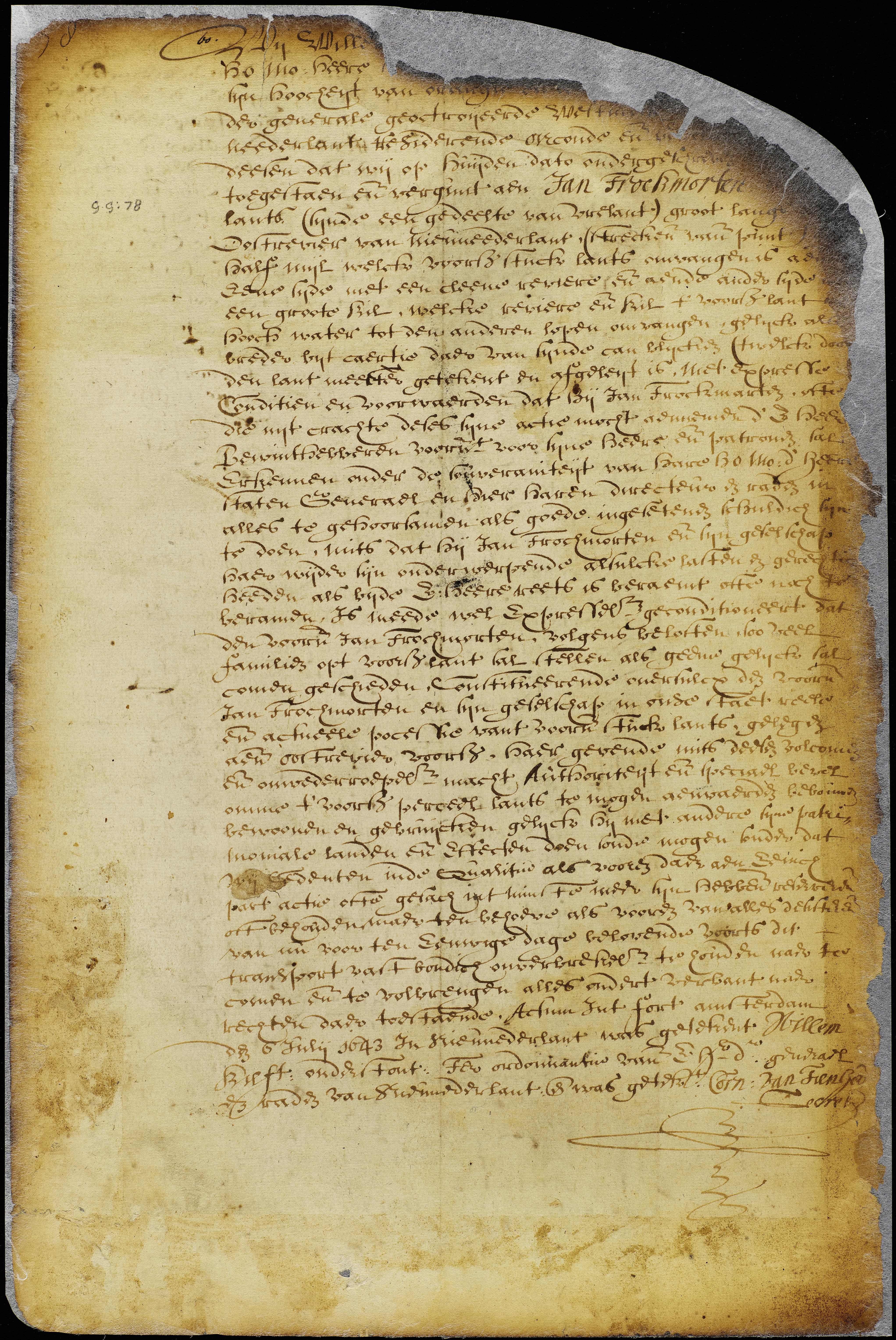
PATENT. John Trockmorton; part of Vreland, being half a league along the East river, as by the map and survey thereof may appear (Throgmorton's neck, Westchester).

Document Date
1643-07-06
Document Date (Date Type)
1643-07-06
Document Type
Full Resolution Image

Translation
Translation

We, Willem Kieft, etc... have conceded and granted to Jan Trockmorton a parcel of land, (which is a part of Vrelant) extending along the East River of New Netherland for one half mile beginning at the point; and bounded on one side by a small river and on the other by a great kil, which river and kil run together at high water surrounding the aforesaid parcel of land, as is shown by the map thereof, made and deposited by the surveyor, under the express condition etc...

Done at Fort Amsterdam, 6 July 1643.

References

From the collections of the New York State Archives, Albany, New York.  https://www.archives.nysed.gov/  

Translation link see: http://iarchives.nysed.gov/xtf/view?docId=tei/A1880/NYSA_A1880-78_VGG_0078.xml

Published bound volume is also available: Translation: Gehring, C. trans./ed., New York Historical Manuscripts: Dutch, Vols. GG, HH & II, Land Papers, 1630-1664 (Baltimore: Genealogical Publishing Co., Inc.: 1980).

Copyright to the published bound volume is held by the Holland Society of New York.
A complete copy of this publication is available on the
New Netherland Institute website.

Location
Locations (Unlinked)
Along East River, Throgmorton's neck, Westchester
Property Type
Property Type
To Party 1
To Party 1 Text Unlinked
John Trockmorton
To Party 1 Entity
To Party 1 Entity Role
From Party 1
From Party 1 Entity Role
Document Location