The original map is held in Italy, and comes to the US on rare occasions for exhibits As of 2024, it is cared for by the Biblioteca Medicea Laurenziana (Laurentian Library) in Florence.
Jacques Cortelyou, the surveyor general of New Netherland in the employ of the DWIC drew the original map. It is however, Nicasius de Sille who made the map fascinating for generations of scholars by creating a census of every house, who was living there, and in many cases he listed their occupations.
This map was exhibited in 2009 at the Southstreet Seaport Museum.
In 2024, the New-York Historical Society was able to bring the map from Italy for it's exhibition, New York Before New York: The Castello Plan.
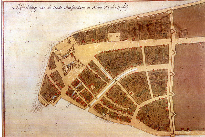
Afbeelding van de Stadt Amsterdam Cortelyou c.1660-1665