Lot
John Danielson - 1675-03-15
Lot Group
Original Grants and Farms
Original Grants and Farms Document(s)
Grant Lot Document(s)
Date Start
1675-03-15
Tax Lot Events
To Party 1 (text)
John Danielson
From Party (Text)
Andros
Full Stokes Entry (See images below)
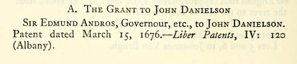
A. The Grant to John Danielson Sir Edmund Andros, Governour, etc., to John Danielson. Patent dated March 15, 1676. — Liber Patents, IV: 120 (Albany).
"Whereas there is a certaine lott of land upon this Island Manhattans, the which, by vertue of my warrant, hath been laid out for John Danielson, lying to the north-east of Dewtell Bay, being in breadth by the river side 40 r., and in length by the land of Jacobus Fabritius 120 r., bounded to the northwest by the Commons, and to the south-west by the land of David Du Four. Containing the quantity of 30 acres, as by the returne of the survey doth and may appeare."
John Danielson to John Jennings. Deed dated May 28, 1681. Not found of record; recited in Liber Deeds, XXV: 159 (New York) .
Conveys same property.
John Jennings and Greta, his wife, to Pieter Bockholst. Deed dated Oct. 22, 1688. Not found of record: recited ibid.
Conveys same property.
Pieter Bockholst and Elsie, his wife, to Daniel Bluit. Deed dated Sept. 25, 1703. Not found of record: recited ibid.
Daniel Blewit and Mary, his wife, to Pieter Bockholst. Mortgage dated Sept. 27, 1703. — Liber Deeds, XXV: 159 (New York). Covers same property. This instrument was recorded for Mr. Pieter Boeckhout. Probably that was the correct spelling of the name.
Peter Boeckhout was appointed surveyor of highways for the Bowery Division of the Out Ward, Sept. 29, 1694. — M. C. C, I: 367.
A mortgage in the old form with reversionary clause was in effect a deed.
No title has been traced into Elias Andries, or Anderson, whose heirs were in possession here before 1738. The entire tract was then known as "The Union Flag Farm." The tavern stood west of the road on the Thomas Addis Emmet farm.
The farm is next mentioned in the following advertisement:
"To be sold at publick Vendue the estate of Elias Andrise, Consisting of the House above Tortoise Bay, known by the name of the Union Flag, and the personal Estate left by Marytje Andrisen; on the loth of February next, for Title and Conditions of Sale enquire of Jacob Anderson, at Turtois Bay on the Rock."— A^. Y. Jour., Feb. 6, 1738.
Eleacom Anderson and Mary, his wife; Anderow Allbody and Annetie, his wife; Pieter Anderson and Cornelia, his wife; Aberam Anderson and Elisabet, his wife; Lucas De Witt and Engeltie, his wife; Samuel Stridc, and Annie, his wife; James Roberson and Selvie, his wife, to Jonaton Hardman, Vintner. Deed dated Feb. 25, 1738. — Liber Deeds, XXXIl: III (New York). Consid., £173.
Conveys "all that messuage or tenement, dwelling house and barn and lot of land situate, lying and being to the north east of Dewtell Bay, being in breadth by the river side 40 r. and in length by the land of Mangell Janse Roll 107 r., 5 ft. and J^. Bounded by the N. W. by the land of Aberam Anderson, from thence with a square line 12 r., 10^ ft.; and from thence with a square towards the N. W. 12 r., 4^^ ft.: bounded by the commons, and to the S. W. by the land of David Devoor. Containing 29 acres.
"All of the land in the Danielson patent except a square acre at its north west corner, in possession of Abraham Anderson."
Committee to lay out the land of Jonathan Hardman and Abraham Anderson "lying a little to the Eastward of Turtle Bay run of water" and to report encroachments on the Common Lands and what portion may be -leased to Abraham Anderson without damage to the neighbourhood, etc. April 4, I739--A/. C. C, IV: 455.
Lawrence Hardman, eldest son and heir of Jonathan Hardman, Vintner, Deceased; Robert Atkins and Frances, his wife (late Frances Hardman, widow of Jonathan Hardman), to Simon Johnson. Mortgage dated July 8, 1756. — Liber Mtges.,1: 45 (New York). To secure £160.
"Covers all that certain tract, farm, piece, lott or parcel of
land, situate, lying and being in the outward of the City of New York, to the N. E. at Turtle Bay, being in breadth by the river 40 r. and in length by land formerly of Jacobus Fabritius, now of John Van Zandt, 120 r., in the rear or along the Commons, in breadth 40 r., and in length along the land of David Devoore 120 r., containing 30 acres. Bounded S. E. along the river; N. E. to the land now of the said John Van Zandt, N. W. to the Commons and S. W. to the land of the said Devoore."
"To Be Let:" "A Small Lot of about 22 Acres, belonging to the noted Tavern, known by the Name of The Union-Flag, about 4 Miles distant from New- York, on the Post-Road, adjoining to the East-River, having a good Wharf, and a good Landing belonging to it: There is on it a good Orchard and Garden. Enquire of James McKinney, living near TurtleBay." — A''. Y. Post-Boy, Jan. 24, 1757.
Between 1757 and 1767, this farm lot, evidently vacant, vested in John Provoost. The source of title has not been ascertained. By his will dated Sept. 23, 1767, proved Nov. 3, 1767 {Liber JVills, XXVI: 80, New York), he devised it to his son, Samuel Provoost, as "my farm with the edifices and appurtenances."
Samuel Provoost and Maria, his wife, to Hugh Gaine. Deed dated June 5, 1784. — Liber Deeds, LI: II (New York).
Conveys the farm by the same description.
Hugh Gaine, of the City of New York, stationer and bookseller and Cornelia, ux, to Josiah Ogden Hoffman, Esq. Deed, dated March 6, 1795. — Liber Deeds, XXVII: 375 (.Albany). Consid., £8,000.
Conveys "All that certain tract or parcel of land, situate, lying and being in the 7th Ward to the Northeast of Deutel or Turtle Bay, Beginning at the N. E. corner of the land formerly of David Devore, deceased, and runs from thence along or near the East River, lo ch. thence N. 45° W. 22 ch. and 40 links to the public road or highway where the breadth thereof is on a S. W. course, 10 ch.; thence along the said public road or highway, S. 9° 30', W. 6 ch.; thence S. 32°, W. 4 ch.; thence S. 23°, W. I ch., 10 links; thence S. 45°, E. 18 ch., 50 links to the place of Beginning; Bounded to the S. E. along the East River; on the N. E. by land which did formerly belong to Jacobus Fabricius, since to John Van Zandt and now belongs to Peter Praa Van Zandt; on the N. W. by the road to Harlem; and on the S. W. by the land late of David Devore, deceased; same as Samuel Provoost and wife to Hugh Gaine, June 5, 1784."
Recorded, July 10, 1795.
Josiah Ogden Hoffman to Thomas Pearsall. Deed dated April 27, 1797. — Liber Deeds, LVII: 399 (New York).
Conveys same property.
Thomas Pearsall died, March 17, 1807. His will, dated June 8, 1805, proved April 9, 1S07, gave to his wife the use of his country seat during lier life. After her death to his son, Thomas C. Pearsall.— /,/^fr mils, XLVI: 531 (New York).
Mr. Thomas Pearsall probably built the house shown on the Randel Map, in the bed of Ave. A between 58th and 59th Sts.
Parcel (B) of this farm was purchased by Mr. Thomas C. Pearsall in 1809.

Lot Event Type