Novi Belgii Novaeque Angliae nec non partis Virginiae tabula
Johannes Jansson and Nicolaes Visscher, 1618-1679 (Cartographer)
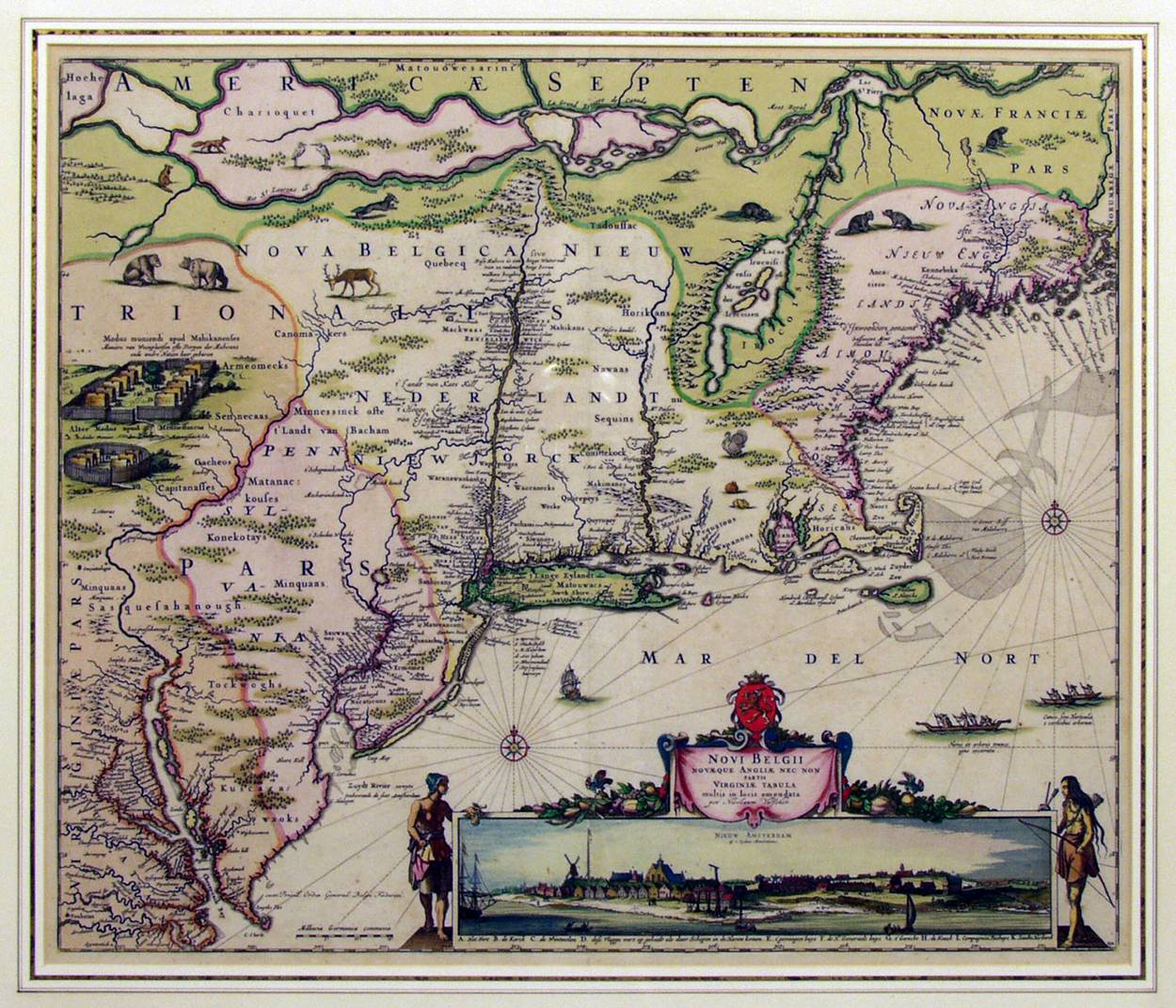
Adriaen van der Donck commissioned the Jansson-Visscher map with color engraved by Johannes Blaue . It showed New Netherland along the original Dutch territorial claim from Cape Hinlopen just south of the Delaware Bay at 38 degrees to the start of New England at 42 degrees and included drawings of typical Indian villages, wild game, Indians in dugouts (mishoon) at sea, and the town of New Amsterdam. The map itself remained the definitive depiction of the area for over a century, cementing many Dutch place names. It would be reprinted thirty-one times before the mid-18th century.
This map was issued several times in Amsterdam, with minor modifications beginning in 1650. This version is from 1651.
It also includes bears, beaver, deer, foxes, turkeys, and rabbits!