Document: The Map of Dutch Grants - 1640-1664

Holding Institution
Description

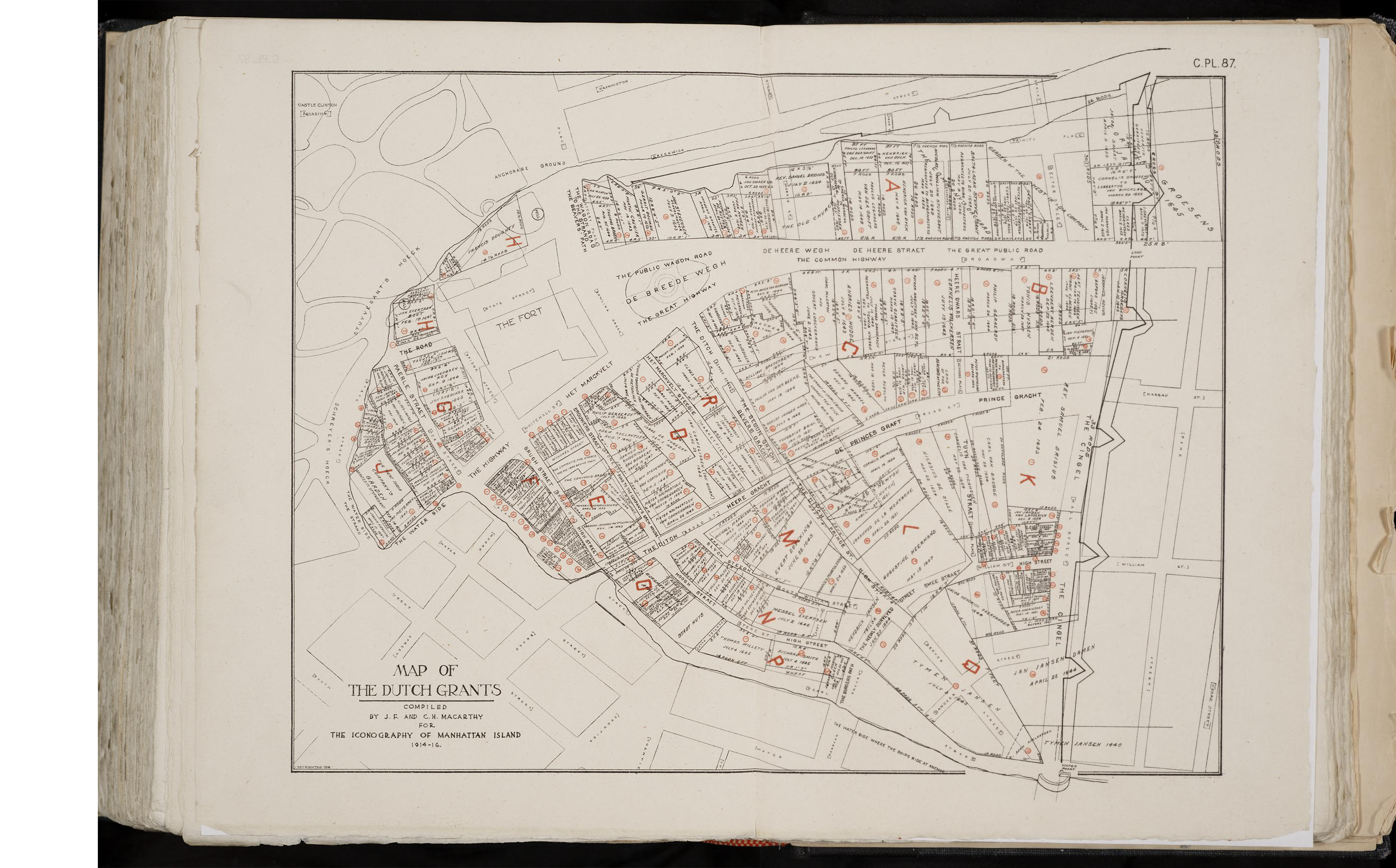
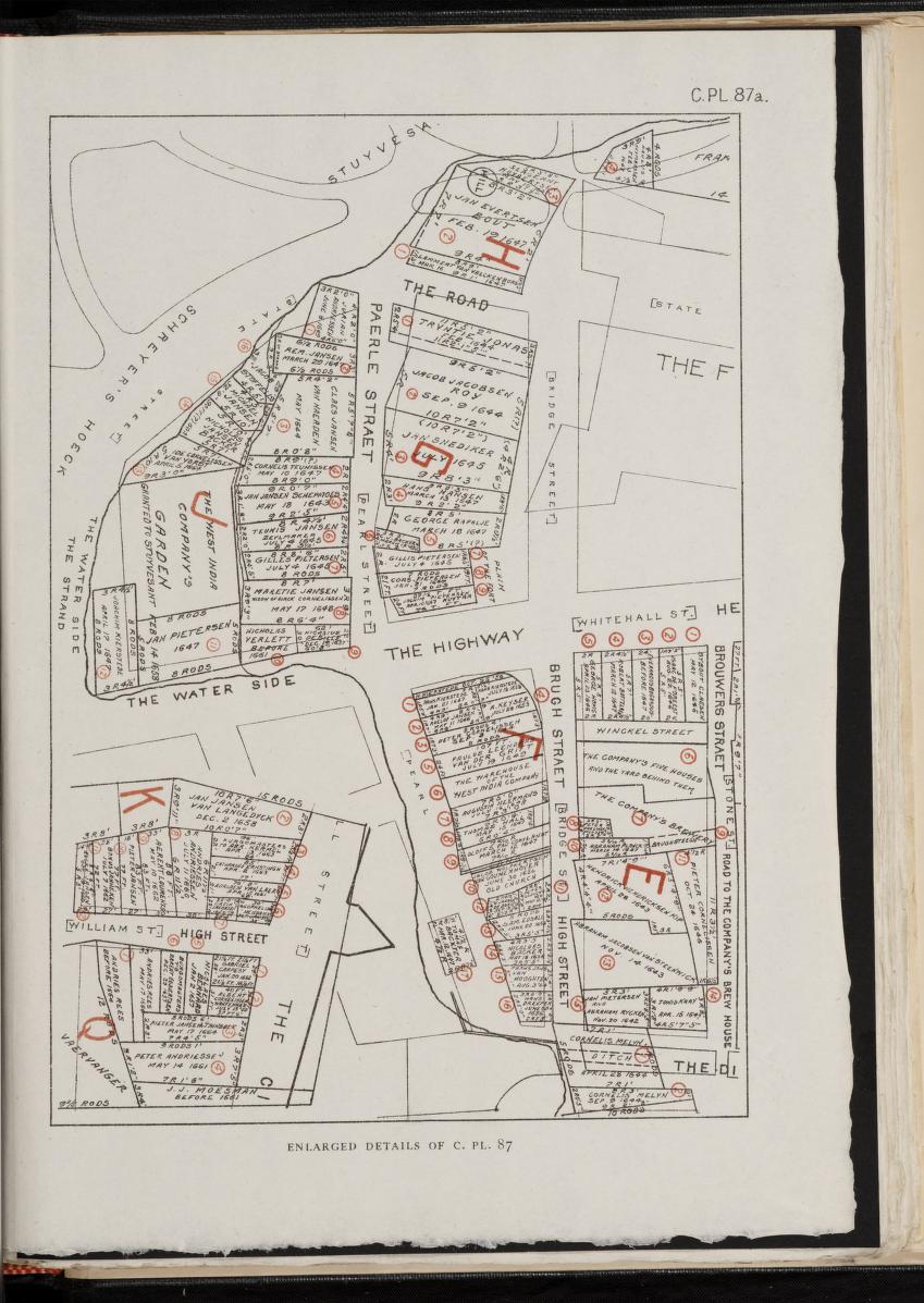
This is a map of the Dutch Grants, drawn from property descriptions, meticulously sequenced and documented in Stokes’ Iconography of Manhattan Island. This map was traced to create the Dutch Grants layer, above. Turn on the Dutch Grants layer group to see information from Stokes’, with a link to the original grant documents. Click the info button for the Dutch Grants layer group for more information.

Document Date
1640-1664
Image
Dutch Grants Map
Enlarged details of Dutch Grants Map
Translation
References

Stokes, I. N. Phelps. The Iconography of Manhattan Island, 1498-1909: Volume 2. 1914-1916. pp. C.PL.87, C.PL.87a. Internet Archive, https://archive.org/details/ldpd_5800727_002/page/n681/mode/2up.

Enlarged details of a part of the map:
https://archive.org/details/ldpd_5800727_002/page/n683/mode/2up

Document Location
Document Finding Aid or Collection